
Fast Facts
- Population
- 6,474 (2020 census); ~6,567 (2021 est.)
- Elevation
- 6,969 ft
- Best Season
- Late spring or September–October
- Nearest Interstate
- I-25, well over an hour south-west — US 64 and NM 68 are the roads
What to Know Before You Arrive
The Pueblo is the reason to come and the reason to prepare. It is a living community, not a preserved site, and its own guidance is specific: obey the Restricted Area signs that protect residents' privacy and sacred places, stay out of homes that are not clearly marked as businesses, stay out of the walled cemetery and the old church ruins inside it, stay out of the river, and treat the village as you would your own home. Closures happen without notice for religious activities or a death in the community. None of that is unusual for a place where people live; it is only unusual to be told it at a gate.
Photography has rules here too, and they are not a formality. Photographing tribal members requires their permission; professional and commercial photographers, and artists sketching or painting, need pre-approval and pay varying fees; and there is “absolutely no photography in San Geronimo Chapel.” Anyone arriving with a camera as the main plan should read the Pueblo's own page before setting out rather than after.
The town beside the Pueblo became an art colony almost by accident at the very end of the nineteenth century. Ernest Blumenschein and Bert Phillips settled here and the first artist colony dates to 1898, though the town's own reference entry gives 1899 in a second place; six artists formed the Taos Society of Artists in 1915. Taos went on to attract Georgia O'Keeffe, and D. H. Lawrence lived at a ranch about twenty miles north-west in the 1920s. The town sits at 6,969 feet, which is part of why the light that drew the painters behaves the way it does.
The Road Trip Stop
Taos Pueblo is the anchor. It opens Sunday to Saturday, 9:00 a.m. to 4:00 p.m., and admission is $25* for adults, $22* for seniors, students aged 11 and over including college students with ID, military, and groups of eight or more adults; ages 10 and under are free.
Check it is open, then go on its terms
- Check the events calendar before you drive. The Pueblo advises checking it for schedule changes, and unexpected closures do occur for religious activities and for a death in the community. This is the one stop in this guide where arriving to a closed gate is not a failure of planning but a fact of the place.
- Read the photography rules first. Permission is needed to photograph tribal members; professional and commercial photographers and artists who sketch or paint need pre-approval and pay fees; no photography at all inside San Geronimo Chapel.
- Keep to the marked areas. Restricted Area signs protect residents' privacy and sacred sites; homes that are not marked as businesses are homes; the cemetery and the old church ruins within its adobe wall are closed to visitors.
- Do not enter the river. It is the community's only drinking water source. It runs straight through the middle of the village, which is exactly why the instruction needs saying.
*Fees subject to change, please check taospueblo.com for updated information.
Neighborhoods
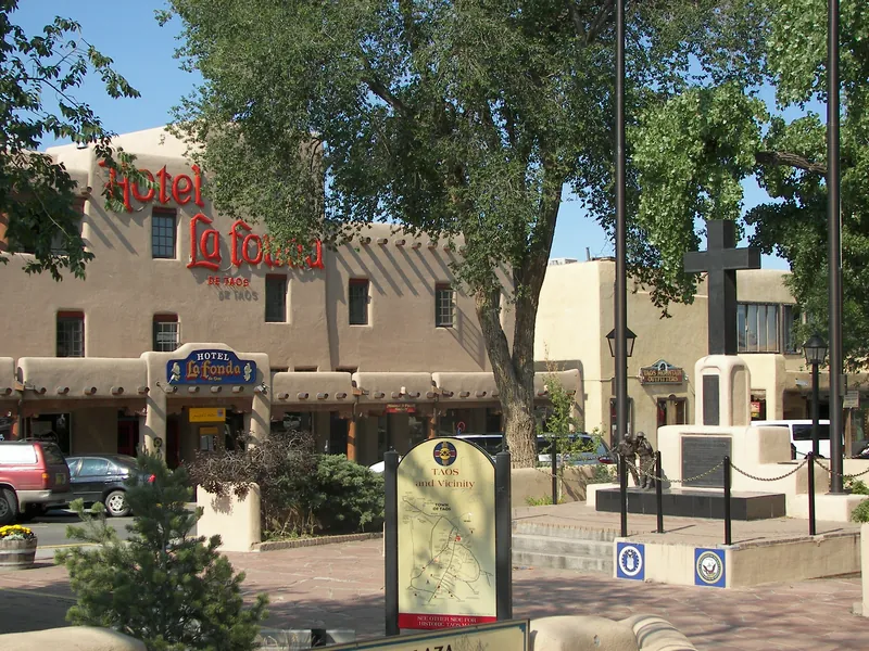
Taos Plaza
The town's Spanish-era centre, dating from a 1796 land grant, a few miles south of the Pueblo (the Town of Taos's tourism pages say two miles on one page and three on another), with shops and galleries around the plaza. It is a separate place from the Pueblo and should not be confused with it.
Paseo del Pueblo
The main road running north–south through town, linking the plaza to the Pueblo road and carrying most of the lodging and restaurants.
The Taos Pueblo lands
North-east of town, a sovereign community with its own government, hours and rules. You are a visitor in another nation's village here, which is the frame to arrive with.
The mesa west of the gorge
Across the Rio Grande on US 64, sagebrush plains with the Sangre de Cristo peaks towering to the east of the bridge. The change in landscape at the bridge is abrupt: the BLM describes the river plunging through an 800-foot gorge at the edge of the Taos Plateau.
The Food Stop
The Historic Taos Inn at 125 Paseo Del Pueblo Norte runs the town's two best-known rooms, Doc Martin's and the Adobe Bar, on the main road a short walk from the plaza. We were unable to confirm their current opening hours: the inn lists both as dining options but does not publish hours on that page. Check directly before building an evening around either, particularly in the shoulder seasons when a town of 6,500 runs a shorter calendar than its visitor numbers suggest.
2 brewpubs within 10 miles of Taos, all with a kitchen.
See all 2
- Eskes Brew Pub106 Des Georges Pl, Taos
- Taos Ale House401 Paseo del Pueblo Norte, Taos
*Check before you go. This list says what the source records as open and where it is — nothing more. Opening hours, whether a kitchen is serving, and whether anywhere suits your family are not in this data and change without notice. A production site may have no public room at all. Please confirm with the venue.
Brewpub locations from Open Brewery DB (MIT)
The Home Teams
No MLB, NFL, NBA, NHL or MLS team plays anywhere near Taos, and at under 7,000 residents the town has no side of its own.
Day Trips
| Destination | Time | Distance | How we got it |
|---|---|---|---|
| The High Road to Santa Fe | 1 hr 45 min | 71 mi | routed |
| South through Chimayó, Truchas and the mountain villages rather than down the river road — two distinct routes between the same two towns. The Town of Taos's tourism page lists the High Road as Highway 76 south through Trampas, Truchas, Cordova and Chimayó, with the “river road” as the way back to Taos, and the New Mexico tourism site describes the High Road to Taos Scenic Byway as 105 miles between Santa Fe and Ranchos de Taos. | |||
| Rio Grande Gorge Bridge and the West Rim | 1 hr 5 min | 35 mi | routed |
| West on US 64 to the bridge and the trail along the rim beyond it. | |||
| Taos Ski Valley | 46 min | 21 mi | routed |
| Up NM 150 north of town to the ski area, which sells scenic lift rides in summer as well. The resort's own page lists the Summer 26 rides as closed, so check its dates before planning around them. The road ends at the village. | |||
| Questa and the Enchanted Circle | 38 min | 24 mi | routed |
| The loop road around Wheeler Peak through Questa, Red River and Angel Fire, which returns to Taos rather than going anywhere. The Town of Taos's tourism page describes it as an 84-mile National Forest Scenic Byway that circles Wheeler Peak, running north on Highway 522 to Questa, east on Highway 38 to Red River, south to Eagle Nest and Angel Fire, and west on Highway 64 back to Taos; the New Mexico tourism site gives the length as 85 miles. | |||
| Ojo Caliente | 1 hr 10 min | 45 mi | routed |
| Mineral springs south-west of Taos, at Ojo Caliente. Wikipedia says the springs were used by native New Mexicans for many years before they were developed in the late nineteenth century, and the resort says it opened its bathhouse in 1868. The resort lists communal day soaking as no reservations required and private soaking as reservations required, so whether booking is needed depends on which one is wanted. | |||
Routed figures are computed over map data at free-flowing speeds, between map points rather than street addresses, so a real drive runs longer.
Distances routed by OSRM and places geocoded by Nominatim, over map data © OpenStreetMap contributors (ODbL)
Worth a Weekend
4 more Highway Heads places lie within about 180 miles of Taos in a straight line — far enough that most are a night away rather than an afternoon.
- Santa FeNew Mexicoabout 55 mi
- AlbuquerqueNew Mexicoabout 110 mi
- DurangoColoradoabout 140 mi
- Colorado SpringsColoradoabout 170 mi
Practical Road Trip Info
The Pueblo's calendar governs the trip, not yours. Check it before committing, and have a second plan for the day in case it is closed.
Nearly 7,000 feet, and the Enchanted Circle goes considerably higher. Arriving from Santa Fe is a modest climb; arriving from Albuquerque is a large one in a single day.
Taos is a long way from an interstate. US 64 and NM 68 are mountain and river roads, and winter weather closes or slows them.
Small town, visitor-scale demand. The town has under 7,000 residents, and both the Pueblo and the ski area north of town are visitor destinations.
4 public campgrounds within 25 miles of Taos, all first-come rather than bookable. Public campgrounds run by federal agencies. State-park and private campgrounds are not included.
The Local Debate
Family-Friendly
The gorge bridge rest area
The rest area on the west side of the bridge has parking, picnic tables, restrooms and the West Rim Trail trailhead, according to the Town of Taos, and NMDOT lists it as open. NMDOT states that pedestrian access to the bridge itself was closed on September 22, 2025, so check its project page before planning a walk across.
Buying directly at the Pueblo
Work is sold by the people who made it, in the village where it was made, which is a clearer lesson than any label. Children aged 10 and under enter free.
Taos Ski Valley in summer
The ski area sells scenic lift rides in summer for views of the Sangre de Cristo Mountains, without a hike up. The resort's page lists the Summer 26 rides as closed, and we were unable to confirm the fees for the current season.
The Earthship tours
Houses built from tyres, cans and bottles. The Visitor Center's self-guided tour is free for ages 12 and under, and the guided tour is $13* for ages 6 to 12 and free under 6.
*Fees subject to change, please check earthship.com for updated information.
Plan Your Visit
Taos Pueblo
- Hours
- Sunday–Saturday, 9:00 a.m.–4:00 p.m.; check the events calendar for changes
- Admission
- Adults $25; seniors, students aged 11+, military and groups of 8+ adults $22; ages 10 and under free*
- Closures
- Closes for about ten weeks from late winter to early spring (call ahead); unexpected closures also occur for religious activities and for a death in the community
- Photography
- Permission required to photograph tribal members; pre-approval and fees for professional, commercial and sketching work; no photography in San Geronimo Chapel
- Respect
- Obey Restricted Area signs; stay out of unmarked homes, the walled cemetery and the river, which is the community's only drinking water
- Link
- taospueblo.com
*Fees subject to change, please check taospueblo.com for updated information.
We checked fees, opening hours and reservations on 2026-10-12. These change without notice — confirm with taospueblo.com, dhlawrenceranch.unm.edu and ojosparesorts.com the week you travel.
Sources — 22 claims, 22 checked against the source on 2026-10-12
| Claim | Source | Status |
|---|---|---|
| Taos Pueblo visiting hours Sunday–Saturday 9:00 a.m.–4:00 p.m.; admission $25 adult, $22 senior, student aged 11 and up including college students with ID, military, and groups of 8 or more adults; ages 10 and under free | Visit — Taos Pueblo | Checked monitored · 2026-10-12 |
| “Unexpected closures do occur for religious activities and an unexpected death in the community”; visitors are advised to check the events calendar for schedule changes | Visit — Taos Pueblo | Checked monitored · 2026-10-12 |
| Photography rules: permission required to photograph tribal members; pre-approval and varying fees for professional and commercial photographers and for artists who sketch or paint; “Absolutely no photography in San Geronimo Chapel&rdquo | Visit — Taos Pueblo | Checked monitored · 2026-10-12 |
| Visitors asked to obey Restricted Area signs protecting residents' privacy and sacred sites, stay out of homes not clearly marked as businesses, stay out of the cemetery including the old church ruins within its adobe wall, stay out of the river as the community's only drinking water source, and treat the village respectfully | Visit — Taos Pueblo | Checked monitored · 2026-10-12 |
| Taos Pueblo was “built between 1000 and 1450 AD, with some later expansion”, has been occupied for nearly a millennium, and is “considered to be one of the oldest continuously inhabited communities in the United States”; added as a UNESCO World Heritage Site in 1992 | Taos, New Mexico — Wikipedia | Checked |
| Population 6,474 at the 2020 census with a 2021 estimate of 6,567; “The elevation of the town is 6,969 feet&rdquo | Taos, New Mexico — Wikipedia | Checked |
| The first artist colony was established in 1898 by Ernest Blumenschein and Bert Phillips; the same page states elsewhere that artists began settling in 1899; six formed the Taos Society of Artists in 1915. The 1898/1899 inconsistency is reproduced rather than resolved here | Taos, New Mexico — Wikipedia | Checked |
| Taos attracted Georgia O'Keeffe; the D. H. Lawrence Ranch about 20 miles north-west was “the home of the English novelist in the 1920s&rdquo | Taos, New Mexico — Wikipedia | Checked |
| The Rio Grande Gorge Bridge crosses the gorge and is “now a part of U.S. Route 64”. The source gives no height for the bridge, so none is stated in this guide | Taos, New Mexico — Wikipedia | Checked |
| The claim that D. H. Lawrence's ashes are buried at the D. H. Lawrence Memorial is marked “citation needed” in the source and is therefore not stated in this guide | Taos, New Mexico — Wikipedia | Checked |
| The Historic Taos Inn, 125 Paseo Del Pueblo Norte, Taos, NM 87571, lists Doc Martin's and the Adobe Bar as its dining options; hours are not published on that page, so we were unable to confirm them | Doc Martin's — The Historic Taos Inn | Checked |
| The Rio Grande Gorge Bridge is 1,272 feet long and approximately 650 feet above the Rio Grande; NMDOT states pedestrian access to the bridge was closed on September 22, 2025; the BLM brochure lists the West Rim Trail at 9.0 miles, easy to moderate | Raise the Rails, Rio Grande Gorge Bridge — NMDOT | Checked |
| San Francisco de Asis Church, Ranchos de Taos: buttressed adobe church photographed by Ansel Adams and painted by Georgia O'Keeffe; townspeople, parish members and visitors re-mud the exterior each June | San Francisco de Assisi Mission Church, Ranchos de Taos, New Mexico — National Park Service | Checked |
| D. H. Lawrence Ranch: ranch history text places it 20 miles north-west of Taos; page lists opening hours Tuesday, Wednesday and Thursday 9:30 a.m.–3:30 p.m. (effective March 12, 2022) and directs visitors via NM 522; the 'weather permitting' wording and current closure notices are on the UNM home page, which has its own row (checked 2026-10-14) | D.H. Lawrence Ranch — D.H. Lawrence Ranch Initiatives, University of New Mexico | Checked monitored · 2026-10-14 |
| D.H. Lawrence Ranch open to the public Tuesday, Wednesday and Thursday, 9:30 a.m.–3:30 p.m., weather permitting; the page carries dated closure notices and points visitors to UNM Facilities Management for weather and environmental conditions (checked 2026-10-14) | D.H. Lawrence Ranch Initiatives — University of New Mexico (home page) | Checked monitored · 2026-10-14 |
| High Road route listed as Hwy 76 south to Trampas, Truchas, Cordova and Chimayó, with the 'river road' as the return to Taos; map covers both the High Road and River Road | The High Road between Taos and Santa Fe — Town of Taos | Checked |
| Describes a 105-mile scenic byway between Santa Fe and Ranchos de Taos through Chimayó and Truchas, ending in Ranchos de Taos | High Road to Taos Scenic Byway — New Mexico Tourism Department | Checked |
| National Forest Scenic Byway that circles Wheeler Peak, 84 miles; route Hwy 64 north to Hwy 522 to Questa, Hwy 38 east to Red River, south to Eagle Nest and Angel Fire, Hwy 64 west to Taos | Enchanted Circle driving tour — Town of Taos | Checked |
| Describes an 85 mile US Forest Scenic Byway connecting Taos and Questa with Red River, Eagle Nest and Angel Fire (the Town of Taos page gives 84 miles for the same road) | The Enchanted Circle — New Mexico Tourism Department | Checked |
| Communal day soaking is listed as no reservations required (none accepted for day soaking); private soaking is reservations required; resort says it opened its bathhouse in 1868 (checked 2026-10-14) | Soak — Ojo Caliente Mineral Springs Resort & Spa | Checked monitored · 2026-10-14 |
| Resort at 50 Los Banos Dr., Ojo Caliente, NM 87549, described by the operator as south-west of Taos (direction used; the operator's time figure is not repeated) | Getting here — Ojo Caliente Mineral Springs Resort & Spa | Checked |
| The hot springs “were used by native New Mexicans for many years” and began to be developed in the late 19th century; the article also records an alternative account that the resort opened in 1880 | Ojo Caliente Hot Springs — Wikipedia | Checked |
Road Trippin’ with the Harts
The Highway Heads books turn the miles between stops into a game the whole car can play.
See the booksLive Conditions
Wildlife Spotted Nearby
Nearest Airports
Straight-line distance from Taos, not drive time.
- Taos Regional (TSM) — 7 miles
- Las Vegas Municipal (LVS) — 57 miles
- Santa Fe Municipal (SAF) — 62 miles
Explore the Full Road Trip
Return to the Highway Heads map and discover the next family-ready stop.
Explore the Map