
Fast Facts
- Annual Visitors
- ~4.4 million (2025)
- South Rim Elevation
- ~7,000 ft
- One Unusual Stat
- Over a mile deep, up to 18 mi wide
- Typical visiting season
- April–May or Sept–Oct
- All-American Road
- Historic Route 66, 1,408.6 miles
What to Know Before You Arrive
A word on scope first, because this stretch of Arizona gets confusing fast: “Grand Canyon Country” here means the road-trip region around the South Rim — Grand Canyon Village, Desert View, and the gateway towns of Tusayan and Williams — not a single address inside the park. The Ancestral Puebloans lived along the canyon for centuries before it had an English name at all; by the 16th century the Hualapai, Havasupai, Southern Paiute and Navajo lived in the surrounding region, and the Pueblo people considered the canyon a holy site worth a pilgrimage. The name itself is recent by comparison — explorer John Wesley Powell was the first to call it the “Grand Canyon” in 1871; before that, it was just the “Big Canyon.”
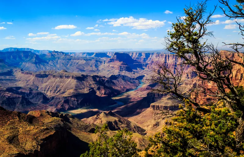
The numbers are almost too big to picture standing at the rim: the canyon runs 277 miles long, up to 18 miles across, and more than a mile deep — 6,093 feet at its deepest. The rock at the very bottom, the Vishnu Schist, is about two billion years old; the limestone under your feet at the rim is a comparatively young 270 million. The river that cut all of it did its main work surprisingly recently in geological terms — recent research points to roughly 5 to 6 million years for the modern canyon’s carving, though some older segments formed tens of millions of years earlier. President Theodore Roosevelt visited in 1903 and said the canyon should “remain as it now is” for everyone after him to see; six years later it became a national monument, and a national park in 1919.
The single biggest planning mistake people make here is treating “the Grand Canyon” as one place. The South Rim is open 24 hours a day, 365 days a year, and takes in roughly 90% of all park visitors. The North Rim sits more than 8,000 feet up and normally closes to vehicles from December 1 through May 15 for snow — and as of this writing it carries extra caveats for 2026: the July 2025 Dragon Bravo Fire destroyed the historic Grand Canyon Lodge, the North Rim Visitor Center and eleven residences, so the North Rim reopened May 15, 2026 with no overnight lodging at all and a strictly limited, day-use-focused season. This guide is written for the South Rim, which is where almost every road trip through here actually goes; treat anything about the North Rim as a special case, not the plan.
The Road Trip Stop
The stop is the South Rim itself — specifically the stretch from Grand Canyon Village east along Desert View Drive. Grand Canyon Village is a National Historic Landmark District of 247 buildings, including the 1905 El Tovar Hotel and the 1905 Hopi House, a Mary Colter–designed trading post built to resemble a traditional Hopi dwelling at Oraibi. None of it prepares you for the first look over the rim anyway — the buildings themselves hold up to a second look once you’ve had that first look.
Budget the time
- Buy the pass before you arrive if you can. A private vehicle is $35* and covers seven days; an annual park pass is $70,* and the park takes card only, no cash.
- Park once and use the free shuttle. The South Rim runs free shuttle buses between the village, the visitor center and the main overlooks, and parking lots fill fast in spring through fall.
- Drive Desert View Drive to the Watchtower for a completely different, much less crowded 25-mile stretch of rim than the village area — budget at least half a day round trip with stops.
- Carry more water than feels necessary. The inner canyon is a genuine desert environment with summer highs over 100°F, and the park’s own advice is to keep several gallons in the car.
*Fees subject to change, please check nps.gov for updated information.
Neighborhoods
Grand Canyon Village
The historic hub, and a National Historic Landmark District in its own right: El Tovar Hotel, Hopi House, Bright Angel Lodge and the old Santa Fe railway depot all sit within a few minutes’ walk of each other on the rim itself. About 1,784 people call it home year-round.
Desert View
The quieter, eastern end of the South Rim, 25 miles from the village, built around the 70-foot Desert View Watchtower that Mary Colter designed in 1932 after six months studying Ancestral Puebloan towers. Inside are murals by Hopi artist Fred Kabotie and “reflectoscopes” — black mirrors that throw an alternate, almost painterly view of the canyon back at you.
Hermits Rest & Hermit Road
The western bookend, eight miles out along Hermit Road to a 1914 Mary Colter rest house built to look like a pile of old stone. Colter’s own line about the effort: “you can’t imagine what it cost to make it look this old.” It’s the westernmost point on the rim reachable by paved road.
Tusayan
The closest thing to a front door: a town of about 603 people, one mile from the South Entrance, that exists almost entirely to house and feed park visitors — its hotels alone outnumber the rooms available inside the park. Tusayan only incorporated as a town in 2010.
The Food Stop
El Tovar Dining Room has been serving from the same rim-side hotel since 1905, when it was built by the Santa Fe Railway’s chief architect as a destination resort at the edge of the wilderness. It’s one of only a handful of original Fred Harvey Company hotels still operating anywhere. Reserve ahead; the canyon view from the dining room windows is the whole reason people book it out.
In Williams, Rod’s Steak House opened in 1946 on Route 66 and became a road-trip institution behind its glowing neon cow sign, before closing during the pandemic. It reopened under new ownership on August 23, 2025 — deliberately timed to its 79th anniversary — with the dining room restored but the character intact.
The Home Teams
Nothing here plays pro or college ball — the nearest college team is Northern Arizona University’s Lumberjacks in Flagstaff, about 80 miles away, and the nearest big-league games are in Phoenix, well over three hours south. Don’t build the trip around sports; the canyon is the whole itinerary.
Day Trips
| Destination | Time | Distance | How we got it |
|---|---|---|---|
| Williams | 1 hr 20 min | 60 mi | routed |
| The other gateway town, an hour from the South Entrance and the southern terminus of the Grand Canyon Railway, which has run the 64-mile route since 1901, stopped in 1968, and came back from private investors in 1989 — exactly 88 years after its first trip. Williams was also the last town on old Route 66 to get bypassed by the interstate, in 1984. | |||
| Cameron & the Little Colorado River Gorge | 1 hr 25 min | 57 mi | routed |
| East on Highway 64, the Desert View entrance sits 25 miles west of the Navajo Nation town of Cameron, home since 1916 to the Cameron Trading Post and a 1911 suspension bridge across the gorge. West of Cameron on Highway 64, the viewpoints of the Little Colorado River Navajo Tribal Park look into a gorge that the tribal park’s own page describes as stretching over 50 miles and plunging up to 3,000 feet in depth. Entry to the overlooks is $5* per person, and the park says National Park passes are not accepted there. | |||
| Flagstaffguide | 1 hr 50 min | 87 mi | routed |
| A mountain college town built around Northern Arizona University, with its own stretch of Route 66 downtown and Lowell Observatory up the hill, where Pluto was discovered in 1930. | |||
| Sunset Crater & Wupatki National Monuments | 2 hr 15 min | 95 mi | routed |
| The longest of the four, and it takes most of a day: a black cinder-cone volcano and a red-rock pueblo site connected by a 35-mile scenic loop road just north of Flagstaff. | |||
1 of these is a place the Hub has its own guide to — marked guide and linked from the name.
Routed figures are computed over map data at free-flowing speeds, between map points rather than street addresses, so a real drive runs longer.
Distances routed by OSRM and places geocoded by Nominatim, over map data © OpenStreetMap contributors (ODbL)
*Fees subject to change, please check navajonationparks.org for updated information.
Worth a Weekend
23 more Highway Heads places lie within about 180 miles of Grand Canyon Country in a straight line — far enough that most are a night away rather than an afternoon.
- Springdale (Zion)Utahabout 90 mi
- Zion National ParkUtahabout 100 mi
- Cedar Breaks National MonumentUtahabout 110 mi
- Kolob CanyonsUtahabout 110 mi
- Red Cliffs Recreation AreaUtahabout 110 mi
- Silver Reef MuseumUtahabout 110 mi
- Snow Canyon State ParkUtahabout 110 mi
- St. GeorgeUtahabout 110 mi
- St. George Dinosaur Discovery Site at Johnson FarmUtahabout 110 mi
- St. George TabernacleUtahabout 110 mi
- Virgin River Canyon Recreation AreaArizonaabout 110 mi
- Frontier Homestead State Park MuseumUtahabout 120 mi
- Kanarra FallsUtahabout 120 mi
- Lost City MuseumNevadaabout 130 mi
- Valley of Fire State ParkNevadaabout 130 mi
- Parowan GapUtahabout 140 mi
- Boulder City (Hoover Dam)Nevadaabout 150 mi
- Hoover DamNevadaabout 150 mi
- Moapa Valley National Wildlife RefugeNevadaabout 150 mi
- BeaverUtahabout 160 mi
- Fremont Indian State Park and MuseumUtahabout 170 mi
- Las VegasNevadaabout 170 mi
- Cove FortUtahabout 180 mi
Practical Road Trip Info
Budget at least a full day for the South Rim, two if you want Desert View Drive and Hermits Rest without rushing either end. The South Rim itself never closes — it’s open 24 hours a day, 365 days a year — but that just means the crowding is a seasonal problem, not an hours problem. The park’s own guidance is that day-use visitors should expect traffic congestion and parking problems, especially during spring break and the summer months, and that the least crowded time is November through February, though winter weather is a major consideration for a trip in those months. The same page says reservations are strongly recommended during spring, summer and fall.
Take the heat seriously. The park’s own guidance calls the inner canyon “a harsh desert environment” with summer highs regularly over 100°F, and it explicitly warns that hiking rim to river and back in a single day is realistic for only about 5% of visitors — for everyone else it’s an overnight trip. Staying on the rim trail and turning back early is not a failure; it’s the plan almost everyone should have.
Park once, then ride the free shuttle. The South Rim’s shuttle network covers the village and the main overlooks, which matters because day-use parking fills up and gets genuinely congested from spring break through summer.
Entrance is $35* per private vehicle, good for seven days, or $70* for an annual park pass; the park accepts cards only, no cash. If the North Rim is tempting you, know that it’s a 4.5-hour, 220-plus-mile drive around from the South Rim — not a same-day add-on — and that its 2026 season runs with no lodging at all after the 2025 fire.
3 public campgrounds within 25 miles of Grand Canyon Country, all bookable ahead. Public campgrounds run by federal agencies. State-park and private campgrounds are not included.
*Fees subject to change, please check nps.gov for updated information.
The Local Debate
Family-Friendly
The paved rim trail near the Village
Flat, stroller-friendly pavement runs between the Visitor Center and Bright Angel Lodge with huge views the whole way — but most of the rim has no fence or railing, so keep a hand on anyone small at every overlook.
Junior Ranger booklet
Free at the visitor center, and a good way to turn a big, slightly overwhelming landscape into a checklist a child can actually complete.
The Grand Canyon Railway from Williams
A scheduled train ride between Williams and the South Rim. The railway’s own pages say musicians roam the train playing Western tunes, a staged Wild West scene plays out at the Williams Depot before departure, and a staged train robbery is a tradition on return trips. Diesel locomotives are its primary power; steam locomotives are scheduled to pull the train on select days from March through October.
Kolb Studio
A short, flat walk to a building with a genuinely wild true story behind it — a movie about a river trip, shown daily in the basement for sixty years, is an easier sell to kids than another overlook.
Plan Your Visit
Grand Canyon National Park — South Rim / Grand Canyon Visitor Center
- Address
- PO Box 129, Grand Canyon, AZ 86023 (Visitor Center off Desert View Drive, Grand Canyon Village)
- Hours
- South Rim open 24 hours a day, 365 days a year; Visitor Center open daily, 8 a.m.–4 p.m.
- Price
- $35 per private vehicle (7 days) · $70 annual park pass · card only, no cash*
- Link
- nps.gov/grca
*Fees subject to change, please check nps.gov for updated information.
We checked fees, seasonal opening and operating status on 2026-09-21. These change without notice — confirm with nps.gov, navajonationparks.org and thetrain.com the week you travel.
Sources — 30 claims, 29 checked against the source on 2026-09-21
| Claim | Source | Status |
|---|---|---|
| South Rim open 24 hours a day, 365 days a year; entrance pass required | NPS — Grand Canyon Hours | Checked |
| Entrance fees: $35/vehicle (7 days), $30/motorcycle, $20/individual, $70 annual pass, card only | NPS — Grand Canyon Fees | Checked monitored · 2026-09-21 |
| Park designated a national monument 1908, national park 1919; 1,217,262 acres; UNESCO 1979; ~4.4M 2025 visitors; South Rim ~90% of visitation; North Rim over 8,000 ft, closed Dec 1–May 15 for snow; ~4.5 hr / 220+ mi between rims; Theodore Roosevelt 1903 visit and quote | Grand Canyon National Park — Wikipedia | Checked |
| Canyon 277 mi long, 4–18 mi wide, 6,093 ft deep; Vishnu Schist ~2 billion years old at bottom, Kaibab Limestone ~270 million years at rim; modern canyon carved roughly 5–6 million years ago; John Wesley Powell first used the name “Grand Canyon” in 1871; Ancestral Puebloans, then Hualapai/Havasupai/Southern Paiute/Navajo by the 16th century; Pueblo pilgrimage site | Grand Canyon — Wikipedia | Checked |
| North Rim reopened May 15, 2026 after the July 2025 Dragon Bravo Fire destroyed Grand Canyon Lodge, the visitor center and 11 residences; no overnight lodging for the 2026 season; day-use, limited-services focus | NPS — Status of the North Rim | Checked |
| South Rim visitor center hours 8 a.m.–4 p.m. daily; PO Box 129, Grand Canyon, AZ 86023 mailing address | NPS — Visitor Centers | Checked |
| South Rim elevation ~7,000 ft; inner canyon a harsh desert environment with summer highs over 100°F; rim-to-river-to-rim is an overnight trip for ~95% of hikers; free shuttle system; parking congestion in peak season, least crowded Nov–Feb | NPS — Basic Information | Checked monitored · 2026-09-21 |
| Williams ~60 min / one hour from South Entrance via I-40; Desert View East Entrance 25 mi west of Cameron, AZ | NPS — Directions and Transportation | Checked |
| Tusayan population 603 (2020); one mile from South Entrance; incorporated 2010; hotel rooms exceed in-park lodging capacity | Tusayan, Arizona — Wikipedia | Checked |
| Williams population 3,202 (2020); nicknamed “Gateway to the Grand Canyon”; last Route 66 town bypassed by I-40, Oct 13, 1984; southern terminus of the Grand Canyon Railway; ~60 mi / one hour from South Entrance | Williams, Arizona — Wikipedia | Checked |
| Desert View Watchtower built 1932, designed by Mary Colter after six months researching Ancestral Puebloan prototypes; 70 ft, four stories; murals by Fred Kabotie; “reflectoscope” mirrors; National Historic Landmark 1987 | Desert View Watchtower — Wikipedia | Checked |
| Grand Canyon Village population 1,784 (2020); National Historic Landmark District, 247 buildings, listed 1975/designated 1987; El Tovar Hotel opened 1905, built by the Santa Fe Railway | Grand Canyon Village, Arizona — Wikipedia | Checked |
| El Tovar Hotel built 1905, designed by Charles Whittlesey for the Santa Fe Railway; one of the few original Fred Harvey Company hotels still operating; 78 rooms | El Tovar Hotel — Wikipedia | Checked |
| Hopi House opened Jan 1, 1905, two weeks before El Tovar; Mary Colter's first Grand Canyon building; built as a working market for on-site Hopi artisans | Hopi House — Wikipedia | Checked |
| Hermits Rest built 1914, designed by Mary Colter to resemble an old stone ruin; Colter's “cost to make it look this old” quote; westernmost paved-road point on the South Rim; National Historic Landmark 1987 | Hermits Rest — Wikipedia | Checked |
| Kolb Studio built 1904–1926 by Emery and Ellsworth Kolb as home and photo studio; 1911 Colorado River film; now a gallery/bookstore; Bright Angel Trailhead adjacent | Kolb Studio — Wikipedia | Checked |
| Kolb brothers' 1911 river-trip film was shown daily in the Kolb Studio auditorium until 1976, the year Emery Kolb died | Kolb Studio — NPS Places | Checked |
| Tusayan Ruin: small Ancestral Puebloan village 3 mi west of Desert View; museum building closed until further notice; self-guided ruin trail open seasonally through the 2026 season, Thu–Mon, 8 a.m.–4 p.m. | Tusayan Museum and Ruin — NPS Places | Checked monitored · 2026-09-21 |
| Shoshone Point: unsigned dirt trailhead on Desert View Drive, ~1 mi service-road walk to an unfenced overlook; open 24 hours; the only South Rim site reservable for private events | Shoshone Point Trailhead — GrandCanyon.com | Checked |
| Rod's Steak House opened 1946 in Williams on Route 66; closed during the pandemic; reopened Aug 23, 2025 under new ownership, timed to its 79th anniversary | Route 66 News — Rod's Steak House reopening | Checked |
| Grand Canyon Railway completed Sept 17, 1901; closed to passengers 1968; reopened Sept 17, 1989 (88 years later); 64-mi route between Williams and Grand Canyon Depot | Grand Canyon Railway — Wikipedia | Checked |
| Cameron, AZ: Cameron Trading Post area, 1911 suspension bridge over the Little Colorado gorge, Navajo Nation town at US-89/AZ-64 | Cameron, Arizona — Wikipedia | Checked |
| The tribal park's page describes the Little Colorado River Gorge as stretching over 50 miles and plunging depths of up to 3,000 feet; viewpoints just miles west of Cameron on Highway 64; $5 per person entry fee to the overlooks, National Park passes not accepted (checked 2026-10-14) | Little Colorado River Navajo Tribal Park — Navajo Nation Parks & Recreation | Checked monitored · 2026-10-14 |
| Flagstaff and Sunset Crater/Wupatki distances and times; North Rim scenic drives; general drive-time estimates from Grand Canyon Village not confirmed on a single fetched page | No source accepted yet | Not confirmed |
| South Rim: day-use visitors should expect traffic congestion and parking problems, especially during spring break and summer; least crowded November through February with winter weather a major consideration; reservations strongly recommended during spring, summer and fall (checked 2026-10-14) | NPS — Basic Information (South Rim seasons) | Checked monitored · 2026-10-14 |
| Musicians roam the train playing the tunes of the West; the Cataract Creek Gang and the Marshal square off at the Williams Depot each morning before the train leaves (checked 2026-10-14) | Grand Canyon Railway — Entertainment | Checked monitored · 2026-10-14 |
| Railway's story page: cowboy singers and musicians stroll car to car on the Williams-South Rim excursion; staged train robbery described as a tradition on return trips (checked 2026-10-14) | Grand Canyon Railway — Shootouts, Robberies, and Cattle-Rustling | Checked monitored · 2026-10-14 |
| The railway's diesel locomotives are its primary movers (checked 2026-10-14) | Grand Canyon Railway — Train Equipment | Checked monitored · 2026-10-14 |
| Steam locomotives are scheduled to pull the train on select days of the month March-October plus special event days; departures may be cancelled (checked 2026-10-14) | Grand Canyon Railway — Steam Schedule | Checked monitored · 2026-10-14 |
| Designated an All-American Road by the U.S. Secretary of Transportation; 1,408.6 miles in AZ, IL, NM, OK, CA, MO; FHWA suggests: You can drive the entire byway in four or five days, but to enjoy it, plan for several days per state (checked 2026-10-29) | Federal Highway Administration: Historic Route 66 | Checked |
Road Trippin’ with the Harts
The Highway Heads books turn the miles between stops into a game the whole car can play.
See the booksLive Conditions
Wildlife Spotted Nearby
Nearest Airports
Straight-line distance from Grand Canyon Country, not drive time.
- Grand Canyon National Park (GCN) — 7 miles
- Flagstaff Pulliam (FLG) — 68 miles
- Page Municipal (PGA) — 71 miles
Also in
A stop on this page turns up in other Highway Heads collections.
Explore the Full Road Trip
Return to the Highway Heads map and discover the next family-ready stop.
Explore the Map